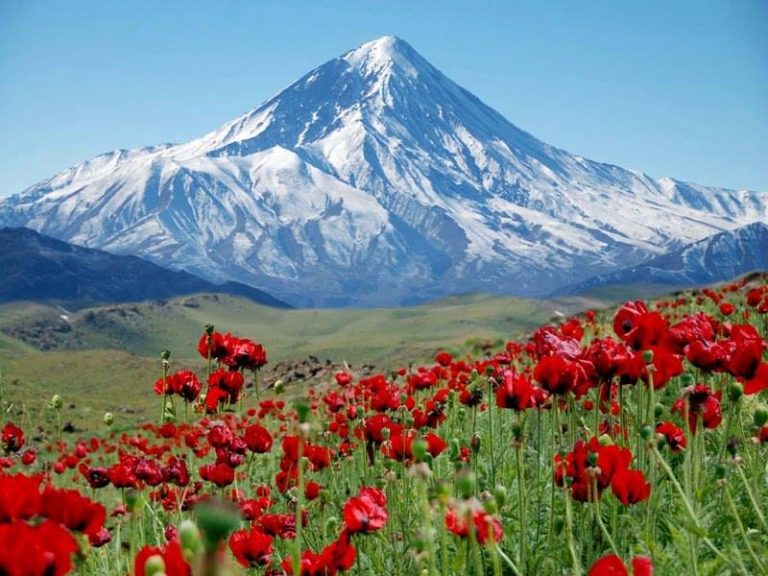
Iran

Flag of IranThe Islamic Republic of Iran is one of the most mountainous countries in the world. It borders with 8 different countries and the Caspian Sea, Persian Gulf, and Gulf of Oman. The country was home to one of the oldest civilizations on earth; The Elamites were established by 4,000BC. The last 100 years have been politically turbulent, a revolution in 1906, a coup in 1953 another revolution in 1979 in which the Islamic state was established a decade-long war with Iraq in the 80s. Today it has a population of 80 million who live in an oppressive autocratic state. The country has 21 UNESCO sites.
Capital city: Tehran Highest Point: Mount Damavand (18,406ft / 5,610m) Lowest Point: Caspian Sea (-91.9ft / -28m) Land Area: 631,726 sq. mi (1,636,163 sq. km) Water Area: 4,645 sq. mi (12,032 sq. km) Total Area: 636,372 sq. mi (1,648,195 sq. km) Coastline: 1,520 miles (2,440 km) Bordering countries (8) Armenia, the Azeri exclave of Nakhchivan, The Republic of Azerbaijan, Turkmenistan, Afghanistan, Pakistan, Iraq and Turkey.
Map of Iran
Map of Iran
Mount Damavand

Mount Damavand

On a clear day, the snow-covered peak of Mount Damavand can be seen in the distance from the Iranian capital Tehran. This snow covered...