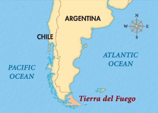
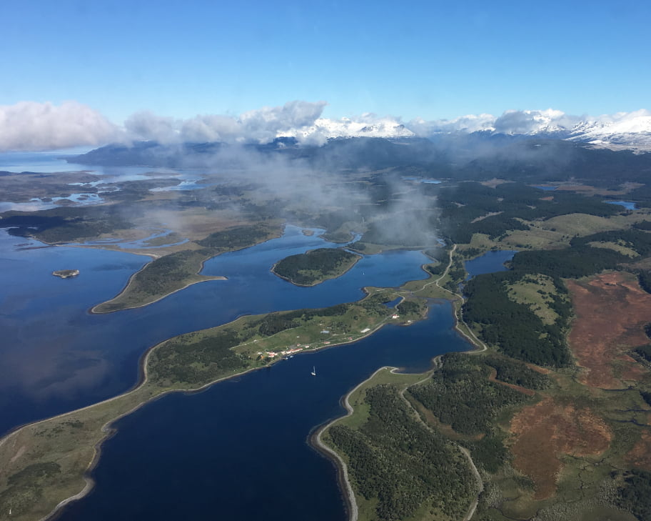
The Beagle Channel is a strait separating the main island of Tierra del Fuego from various other small islands. It is one of three navigable routes linking the Atlantic and Pacific Oceans at the southern tip of the South American continent.

The Strait of Magellan is further north lying between Tierra del Fuego and mainland South America with Drake’s Passage being the southerly open-sea course favoured by the majority of commercial shipping. The sovereignty of many of the islands in this region has been the subject of long-standing disputes between the Chilean and Argentinian Governments but the boundaries have now been amicably agreed and the westernmost section of the Beagle Channel now runs between Argentinian and Chilean lands with the eastern section coming completely under Chilean control. The Beagle Channel is around 240 kilometres in length and 5 kilometres wide at its narrowest point.

Ushuaia
The main centre of population is Ushuaia which is the capital city of Tierra del Fuego. It is generally considered to be the most southerly city on Earth and is commonly referred to as The End of the World a point often disputed by the people of Puerto Williams which lies even further south. Ushuaia lies in a bay on the northern shore of the Beagle Channel and, although in the past this would probably have represented journey’s end for most travellers, the boom in the Antarctic tourism industry means that this is now often the starting point for many modern-day explorers with cruise ships regularly using this port. Although many people will simply pass through Ushuaia, it has an interesting past, the museum previously being a prison reserved for the very worst offenders. The prisoners were responsible for building much of Ushuaia including the construction of the railway called, rather unsurprisingly, Tren del Fin del Mundo.

Beagle Channel Climate
The climate of this region is influenced by many things. It is generally cold and many glaciers are present which would normally qualify it for the description “tundra” but there is a strong maritime influence and heavy forestation. The average winter (July) temperature is 1.3 degrees Celsius rising to 9.6 degrees Celsius in January. Snowfall is common and can even occur in the middle of summer. At a latitude of around 54.8 degrees south temperatures are considerably lower than would normally be expected and, by comparison, the English city of Newcastle upon Tyne sits at a latitude of 54.9 degrees north with not a glacier in sight! The southern hemisphere is of course greatly influenced by the continent of Antarctica and in this part of the world the Antarctic circumpolar current takes a northerly detour as it passes between the northern tip of the Antarctic Peninsula and southern Patagonia.

Beagle Channel Map
Only by looking at this region on a map can the number of small islands really be appreciated. The channel is of course named after the Royal Navy survey ship of the same name which first visited the area when carrying out hydrographic surveys of this section of coastline on its maiden voyage between 1826 and 1830. Although no claim of discovery could really be justified, as this area had been inhabited for at least 10,000 years, this was certainly the first time that accurate maps and charts had been produced. The Beagle returned to this region on its second voyage this time carrying a young naturalist called Charles Darwin. It was in the Beagle Channel that Darwin recorded seeing his first glacier on 29th January 1833. Darwin’s role on the ship is rather hard to explain and was officially recorded as Self-financing supernumerary but he certainly played an active part in the survey work. Much of the detailed work in the channel involved travelling in small boats with overnight camping stops. It was during such a stop that a sudden fall of glacial ice caused a huge wave threatening to wash away the boat and it was only retrieved due the quick action of Darwin and a few colleagues. The ship’s captain rewarded his courage by naming one of the overlooking mountains after him along with the expanse of water at the western end of the channel now known as Darwin Sound.

Beagle Channel Cruise
Those embarking on an Antarctic cruise will almost certainly begin their adventure from Ushuaia following the Beagle Channel eastwards towards the Atlantic. Many of the region’s resident animals can be observed including sea-lions, seals, penguins and occasionally minke whales or Peale’s dolphins. Many southern sea-birds can be seen including the mighty albatross. Close to the point where the channel meets the ocean stands the Les Eclaireurs lighthouse with its distinctive red and white stripes. It is often referred to as Faro del fin mundo or the lighthouse at the end of the world but it should not be confused with that which featured in the famous Jules Verne novel which was the San Juan de Salvamento lighthouse on the Isla de los Estados. Other boat cruises are available allowing visitors to fully appreciate the spectacular scenery along the whole length of the Beagle Channel. Here can be seen numerous glaciers and reflections of snow-tipped mountains in the calm waters. Depending on the season, colonies of penguins and cormorants can be seen. Proceeding further westwards, the channel forks where it meets Gordon Island with the north channel leading to Darwin Sound and the south channel terminating at Cook Bay. With such spectacular scenery, a boat trip along the Beagle Channel really is worth travelling to the end of the world for!


My wife and I went here in the fall and had such an amazing time. It feels like you are travelling through mother nature and watching from a protected bubble when you are on a cruise. We both plan on going back again. For anyone reading this who has never been to the Beagle Channel, GO! You will not regret it. I had more fun during this trip than my honeymoon in Hawaii (Don’t tell my wife that!) haha
great review Matt I am really looking for to it, dont worry your secret is safe with me ho ho
Stephen < UK
I cruised the channel in April of 2008. It was an unforgettable journey. The cold, timeless beauty of the glaciers along the way, the surprise of an unexpected snowfall, the purity of the air and the skies. ..I have been to many beautiful and far away places but this is one trip that I long to repeat.
Can someone at Beautiful World check the second paragraph? Where it says “the westernmost section of the Beagle Channel now runs between Argentinian and Chilean lands with the eastern section coming completely under Chilean control”, I think the directions are reversed. The western half is completely within Chile. The eastern half runs between Argentina and Chile.