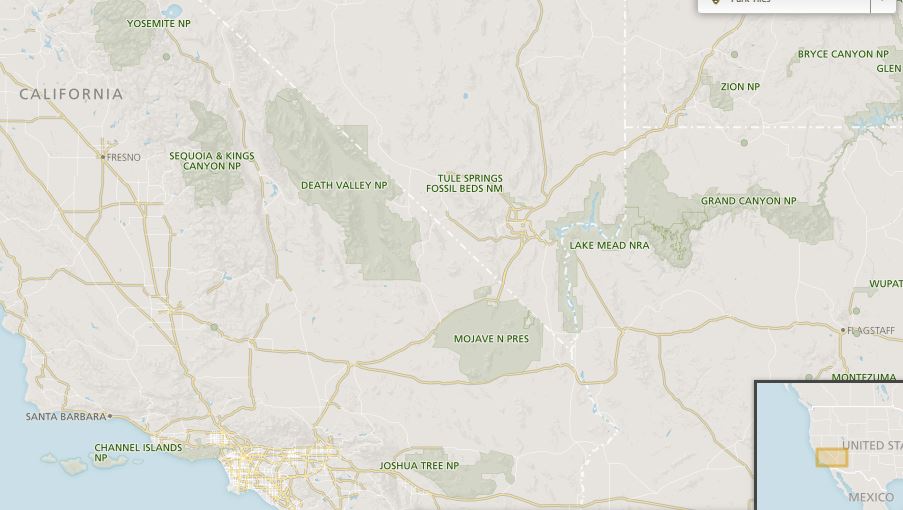
Nestling high in the Sierra Nevada mountains approximately 200 miles (320 kilometres) south-east of San Francisco, Yosemite National Park in Mariposa County, California is one of the United States’ most popular scenic visitor attractions with around 4 million visitors each year.
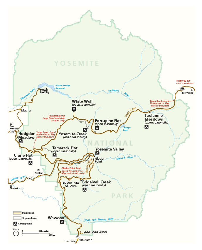
The Yosemite National Park (UNESCO World Heritage Site listing in 1984) now includes not only the Yosemite Valley but many of the surrounding mountains stretching across the Sierra Nevada mountain range. It covers an area in excess of 3,000 square kilometres. It is noted for its breath-taking scenery with immense granite mountains, spectacular waterfalls and ancient sequoia trees. The map below shows the location of the park within the United States. Download a detailed map of Yosemite park here.
Yosemite Valley History
Although archaeological evidence shows that this area has definitely been inhabited for around 3,000 years and probably for around 8,000 years, it really only came to the attention of the European-Americans during the so-called American Indian Wars of the mid-nineteenth century which were intended to suppress the native American population. The name Yosemite was incorrectly derived from a Miwok word meaning “killers” referring to a particularly fierce group residing in the area at that time. Prior to that, the area was known as Ahwahnee and the people living there were the Ahwahneechee.
The mid-nineteenth century saw a great migration westwards largely fuelled by the quest for gold now usually referred to as the Gold Rush. Military action in the area was well reported and the wonders of Yosemite described to a nationwide audience.
Abraham Lincoln established the Yosemite Grant in 1864 which originally applied only to the Yosemite Valley. This preceded the establishment of the first US National Park at Yellowstone but National Park status for Yosemite followed in 1891.
With the wild west well and truly tamed, it was only a matter of time before tourism became popular and far-sighted entrepreneurs soon began developing suitable facilities for the new visitors such as the Ahwahnee Hotel (recently renamed the Majestic Yosemite Hotel) originally built in the 1920s. Today’s visitors have no shortage of choices regarding accommodation and can even opt to get more down to nature by staying at one of the region’s camp sites.

Yosemite Valley
Although the Yosemite National Park covers an area of around 3,000 square kilometres, most visitors are content to restrict their exploration to the 18 square kilometre Yosemite Valley which tends to be the heart of the area with many facilities and attractions including the Mariposa Grove of giant sequoia trees many of which are between two and three thousand years old.
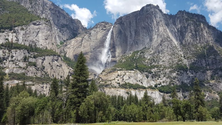
A huge fallen tree known as the Fallen Monarch is a popular attraction and it famously appeared in an 1899 photograph along with a full army unit. Within the valley can be found the Yosemite Museum displaying the valley’s history and cultures and the Pioneer Yosemite History Center is a group of restored old buildings which are usually open to the public. Most people however come to Yosemite to experience some of the world’s most spectacular scenery and many of the area’s most iconic landmarks can be easily viewed from the valley including the Yosemite Falls, El Capitan, Cathedral Rocks, Bridalveil Fall, Cathedral Spires, Sentinel Rock, Three Brothers, Eagle Peak, Half Dome and much more.
Yosemite Falls
Yosemite Falls is the longest waterfall in North America with a total drop of 740 metres. It is made up of three sections, the Upper Yosemite Fall, the Middle Cascades and the Lower Yosemite Fall. It can be observed from many different viewpoints and is at its most spectacular in spring.
We have written a full page just on the Yosemite falls so if you would like to know more please read out Yosemite Falls page.
The original Awahneechee settlements were close to the base of this waterfall and according to legend, the deep plunge pool at the base of the falls was inhabited by the spirits of witches known as Poloti. A folk-tale describes how a woman once went to the pool to collect water only to find her pail full of snakes. Later that night, the spirits caused high winds to pull the woman’s home, including herself and her new-born child into the pool.
Other Yosemite National Park Waterfalls
Yosemite Falls may be the most famous but the park has numerous other spectacular waterfalls some of which flow all year round and others being seasonal features usually at their most impressive during spring. There are also a multitude of short-lived ephemeral waterfalls appearing after periods of rainfall. Some of the best-known waterfalls are:-
Horsetail Fall – The east side of El Capitan gives rise to this unique waterfall which comprises of two streams. This waterfall is famous for catching the light of the setting sun during a few weeks in February causing it to become illuminated and having the appearance of a torrent of liquid fire.

Vernal Fall – This is one of the most powerful waterfalls dropping a distance of 96 metres. This waterfall is not visible from the floor of the Yosemite Valley but necessitates a short hike beginning from the Happy Isle Nature Center.
Nevada Fall – This is another spectacular waterfall accessed via one of the clearly marked trails and it is next to the Liberty Cap peak.
Ribbon Fall – The longest single-drop waterfall in North America, the Ribbon Fall is found on the west side of El Capitan but it usually only flows in early spring.
Bridalveil Fall – One of Yosemite’s most iconic waterfalls reached by an easy hike. It flows almost all year with the possible exception of late summer/early autumn.

Yosemite National Park Mountains
The whole of Yosemite National Park forms part of the Sierra Nevada mountain range but the park is home to many famous peaks including:-
El Capitan – A huge granite monolith with a sheer rock-face. Reaching up 914 metres above the valley floor.
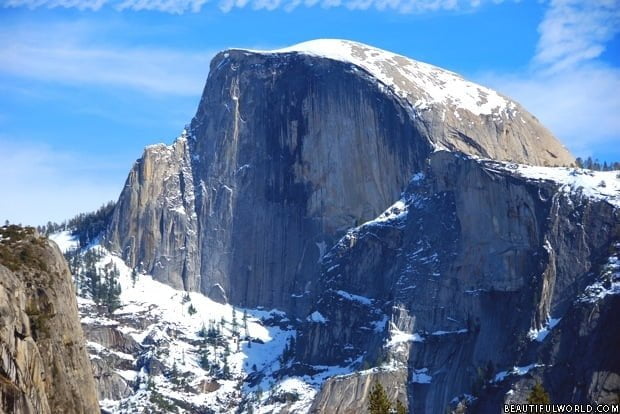
Half Dome – This is one of the United States’ most recognised mountains. As its name suggests, this would have had a dome-shaped summit were it not for the fact that half of it appears to be missing leaving a sheer cliff-face on one side.
Cathedral Rocks / Cathedral Spires – A group of three pinnacles on the East side of the valley which Bridalveil creek passes through. Higher, Middle, and Lower Cathedral Rocks are rock climbing sites.
Sentinel Rock – A tall obelisk which can be reached in a few hours via a relatively easy trail from Glacier Point Road. The views from the top are fantastic.

Eagle Peak – Not as spectacular to look at as some of the other formations but the view from the top is fantastic and of the Southern valley. The hike is of medium to hard difficulty.
Three Brothers – A formation of three peaks resembling roof gables.
Glacier Point
Glacier Point is well-signposted and makes a great first or last stop on a day trip. Due to snow and ice the point is only accessible by car from around May to October/November.
A good (but narrow and winding) road takes you up, up and even further up to Glacier Point which is 980m above the Yosemite valley floor. There is a good car park and cafe at the top and several wheelchair-accessible paths that take you to several spectacular viewing points. Only from up here can you truly appreciate the sheer scale of the valley, falls and mountains. In particular, the views of half dome and the Yosemite Falls are not to be missed.

Yosemite National Park Flora and Fauna
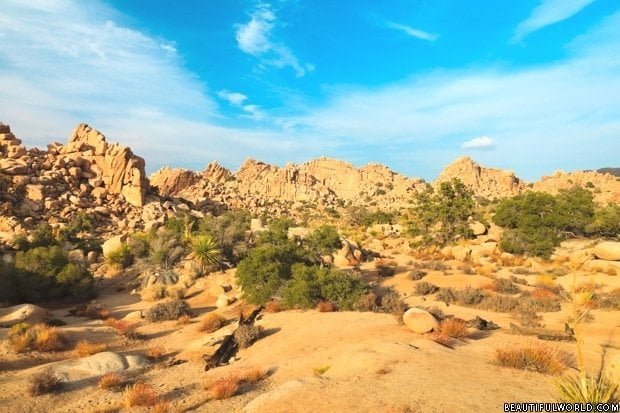
95% of land within the National Park boundary is classified as wilderness with vast expanses of bare rock but many parts are densely forested, the lower altitude west boundary containing mixed coniferous stands of species such as Ponderosa pine, white fir, Douglas fir and some giant sequoias. At higher altitudes, pure stands of specific species can be found including red fir, western white pine, Jeffrey pine and lodge-pole pine, the later being so named because its straight poles were favoured by native Americans when building their teepees or lodges. The unique granite landscape contains many rare flower species. Coyotes, cougars and bobcats are among the predator species to be found and the black bear has always been attracted to any easy food source such as may be found in waste bins, camp sites and even in parked cars. In recent years, measures have been taken to make these vulnerable areas less susceptible to the Ursine pillagers.
Yosemite National Park Entrances
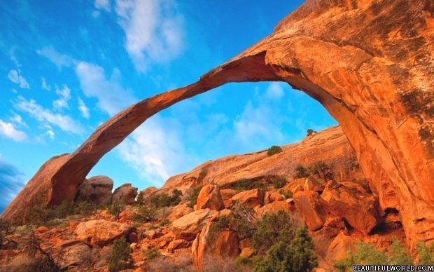
There are five entrances into the Yosemite National Park with four being located along the western border and a single entrance on the eastern side. On the western side, the most northerly entrance is Hetch Hetchy giving easy access to the Hetch Hetchy valley which now contains a reservoir. This is one of the least crowded entrances. Further south is the Big Oak Flat entrance which is one of the favourites for those travelling from the Bay area. To the south of this is the Arch Rock entrance where, of course, the road passes through the famous stone. The most southerly entrance is simply called the South entrance. The Tioga Pass entrance is located on the eastern side and is usually used by travellers from that direction such as those coming from Las Vegas.
The valley floor is surprisingly compact and most of it is perfectly accessible by hiking from Yosemite Village. However, if you are only visiting for one day you may not have time so you can use your car to drive around the valley ‘ring-road’. The road has lots of parking spots so you can take photos and enjoy short strolls to the falls or along the river. Note there is also excellent public transport (download a map) around the park so you don’t need a car.
Yosemite National Park Weather
California is noted for its sunshine but at the higher altitudes of the Sierra Nevada range, things can be expected to be a little different. The Yosemite summers, from June to September, tend to be pleasantly warm or hot with little rainfall. Autumn, October to November, is the most variable time of year and almost any type of weather can be expected. It can be hot, cold, wet, dry or even snowing. Winter, December to March, is a more settled season generally being snowy and cold, although some warm days occur. Spring, April to May, is usually warm and sunny but with a risk of the occasional wintry storm.
What to Do in Yosemite National Park
There is no doubt that a great deal of the park can be enjoyed from the park buses or public roads. However, to experience the park at its best you can enjoy one or more of the many hiking trails. The official park website and ranger stations provide detailed information and maps – for example, check out these day hikes.
Yosemite National Park offers some of the finest scenery to be found anywhere but the park is managed in a way that enables visitors to actively participate in the Yosemite experience. The reliable winter snows make it ideal for many winter sports and, for the rest of the year, the well-defined walking trails allow for close-up contact with many natural features.
The waters of the lakes and rivers allow a variety of pursuits such as fishing (strictly controlled), kayaking or even white-water rafting. Some facilities concentrate on the history of the area thankfully stopping short of turning the Yosemite Valley into a wild west theme park. There is no denying that much of the development has been primarily for the benefit of the visitors rather than for the conservation of the natural environment but this is regarded as a place to be enjoyed.
There is no shortage of hotel and lodge accommodation but most people simply visit for the day. Having said that the park can get very busy during the Spring when the falls are at their best – if you don’t book well in advance you will not be able to find accommodation in the park itself. Bear in mind that many of the closest towns are well over an hour away and with entry queues this can eat into your time in the park. If you plan to do a lot of walking book in advance so you are not wasting time travelling to and from the park.

Glacier point is definitely worth a visit. The views are stunning and there are fantastic opportunities for photographers to take panoramic shots.
How did Bridal Veil Falls form?