 Lebanon is a small country in Western Asia, spanning a total area of 10,400 sq. km (4015 sq. mi), making it comparable in size to the U.S state of Connecticut. It is a mostly mountainous country, with the Lebanon Mountains central and west, and the Anti-Lebanon Mountains stretched across the eastern border with Syria. The two mountain ranges are separated by the flat and fertile Bekaa Valley, whilst there is also a flat and narrow coastal strip of land fronting the Mediterranean Sea. The highest point in Lebanon is the Qurnat as Sawda which rises 10,128ft. (3087m). Many small rivers flow from the mountains, with Litany the most significant, as it irrigates the heart of the Bekaa.
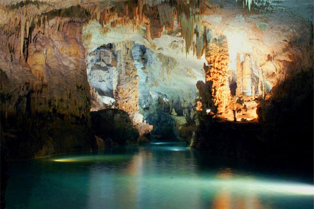
Jeita Grotto
Jeita Grotto, the longest cave in the Middle East, is situated approximately 11 miles (18km) north of Beirut. It consists of two separate, but interconnected, limestone caves, and boasts a length of 5.6 miles (9km). One of the worlds most amazing agglomerations of stalactites and stalagmites, Jeita Grotto is widely considered to be the pride…