Rio de Janeiro is one of the most famous cities in the world. It conjures up images of beautiful people on long beaches, fantastical carnivals, and of course, the stunning bay overlooked by a huge statue of Jesus sited on the peak of Mount Corcovado.
Geography Of Guanabara Bay
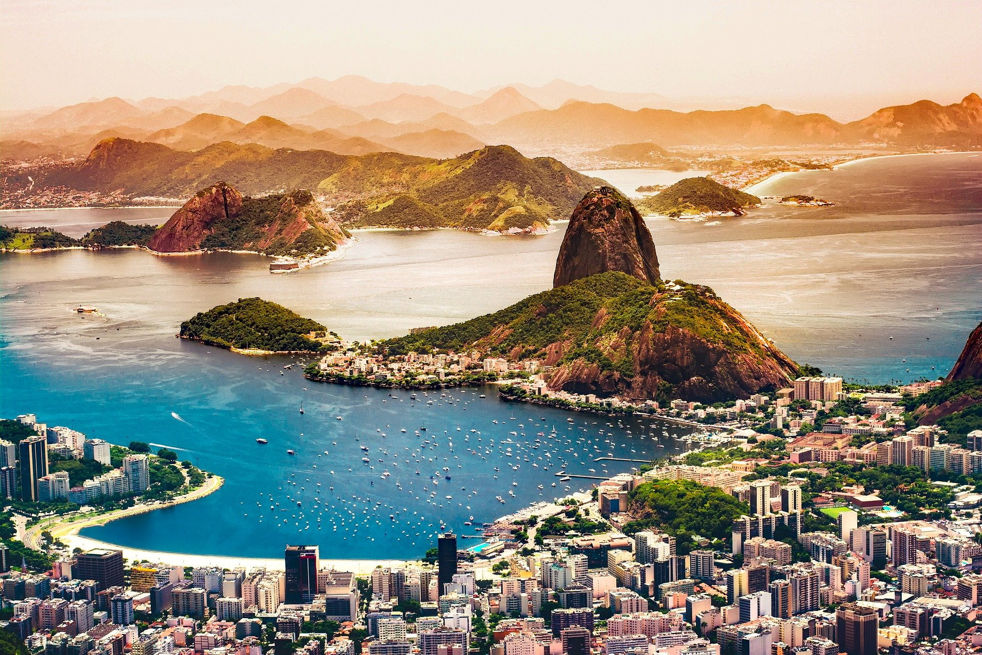
The city of Rio de Janeiro has grown on the west side of the mountainous bay of Guanabara (Baía da Guanabara). The bay is 18 miles (29km) long and wide which means its western edge also has room for the city of Duque de Caxias and both the cities of Niterói and São Gonçalo lie on its Eastern edge.

At the mouth of the bay is another collection of towns which include the often sung about Ipanema and Copacabana.
The bay houses over 130 islands of varying sizes. Fundão and Governador are the largest and are connected to the mainland by multiple bridges. Rio-Niterói Bridge spans 13.29 kilometres across the mouth of the bay connecting the eastern and western sides.
Mountains of Guanabara Bay
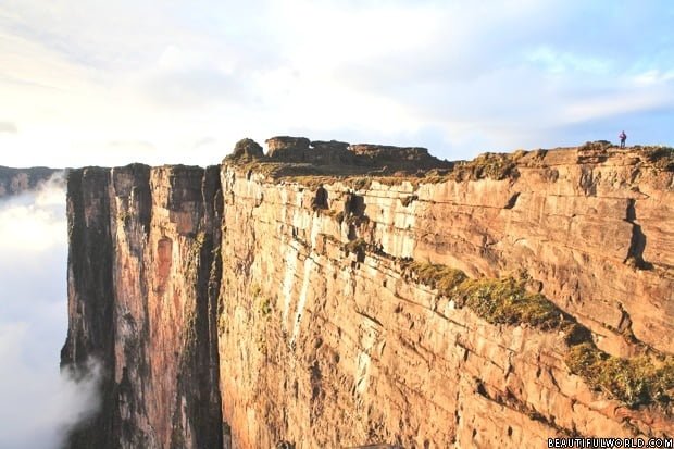
Many people think the only mountain at Guanabara Bay is Corcovado which is famous because of the huge statue of Jesus which has been constructed on its peak. See below for more information on the mountain and statue. In fact, there are several Guanabara Bay mountains.

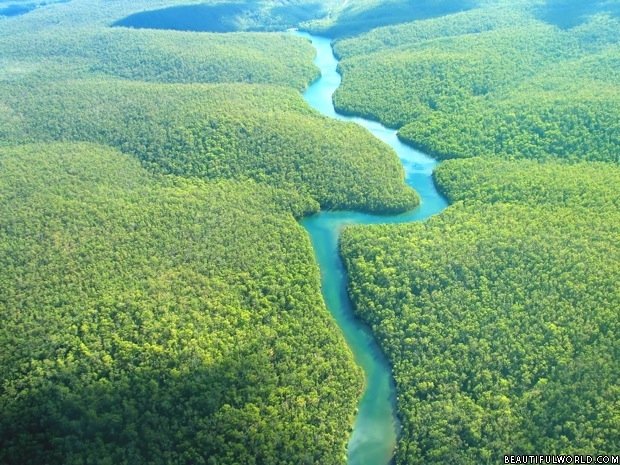
The South West of Rio nestles against the Tijuca National Park. This area was forested until the Europeans arrived who completely cleared the area for timber and farming during the 1700s. This resulted in severe water shortages to the city combined with flash floods. The city decided to replant the area and work began in 1862. Now it is densely forested land which became a national park in 2011. The area is very mountainous and Tijuca Massif. Among its impressive peaks are the Pedra da Gávea and Corcovado mountains.
The height of the Guanabara Bay mountains;
- Tijuca massif at 1,021m (3,350 ft)
- Pedra da Gávea 842 m (2,762 ft)
- Corcovado 710 m (2,329 ft)
The entire bay is surrounded by hills which gives it such a dramatic appearance. There are far too many to list all of them but here are a few.
- Sugar Loaf 396 m (1,299 ft) and adjoining Urca Hill 22m (721 ft)
- Cara de Cão hill 87m (285 ft)
- Morro do Dendê 101m (331 ft)
- Morro do Urubu 218m (715 ft)

In addition to the mountains and hills that are situated directly on the coastline of the bay there are a large number of huge mountains that tower behind Guanabara Bays North and East edges mainly in the parks of Serra dos Órgãos National Park and Reserva Biológica do Tinguá. This adds to the amazing visual backdrop of the bay. Some of the tallest are;
- Pico Maior de Friburgo 2 366m (7,762ft)
- Seio da Mulher de Pedra 2 048m (6,719ft)
- Pedra do Sino 2 255m (7,398ft)
- Morro da Luva 2 263m (7,425ft )
- Agulha do Diabo 2,050 m (6,726 ft)
- All these peaks are between 1500m and 2000m tall; Cume da Serra do Morro Queimado, Dedo de Deus, Pedra da Ermitage, Pedra do Inferno, Maria Comprida, Pedra Comprida de Araras, Pico do Couto, Tinguá.
If you want a complete picture you can view the peaks here and scroll your way around the bay seeing the huge number of hills and mountains and their height.
Corcovado & Statue of Christ

The incredible statue of Christ the Redeemer is 30 metres tall and 28 metres wide and it is entirely faced in sandstone panels. The foundation was started on the 4th of April 1922. This date was chosen to mark 100 years since Brazil had become independent from Portuguese rule. The statue was completed by 1931.
The History of Guanabara Bay
The Portuguese explorers Gaspar de Lemos and Gonçalo Coelho were the first Europeans to visit the bay in 1502. It was of course already well known to the local Tamoio and Tupiniquim tribes who lived on its shores.
It was left in peace until 1555 when the French arrived under the command of Nicolas Durand de Villegaignon. The French tried a few Island sites before building Fort Coligny on Serigipe Island. However, in 1563 the Portuguese came back and expelled the French. This time the Portuguese made the bay impenetrable by constructing a series of forts to house heavy artillery (Santa Cruz, São João, Lajes & Villegaignon).

Rio de Janeiro
The city was founded in 1565 by the Portuguese and became the capital of their state of Brazil. It was also briefly the capital of the Portuguese empire when Queen Maria I of Portugal moved her court there from Europe. In 1822 the violent struggle for independence from Portugal began. After this, the city became the capital of the newly independent Empire of Brazil until 1960 when Brasilia became the capital of Brazil.

Today the city is the second-largest in Brazil a huge centre of industry, universities and research. Its vibrancy and stunning location make it a very popular destination for tourists.
Sugarloaf Mountain
The iconic Sugarloaf Mountain rises 396 m (1,299 ft) above the sea at the mouth of the bay. You can take a cable car up to the peak from where there are fantastic views of the cities and bay.
Rio de Janeiros Aiports
There are two airports in Rio; Santos Dumont airport (also known as SDU) and Rio de Janeiro–Galeão International airport (GIG). GIG is very centrally located on the island ‘Ilha do Governador’ and is the largest serving national and a large number of international flights from the USA and Europe. SDU is only 2km from Rio and only serves national flights.