Lake Bled
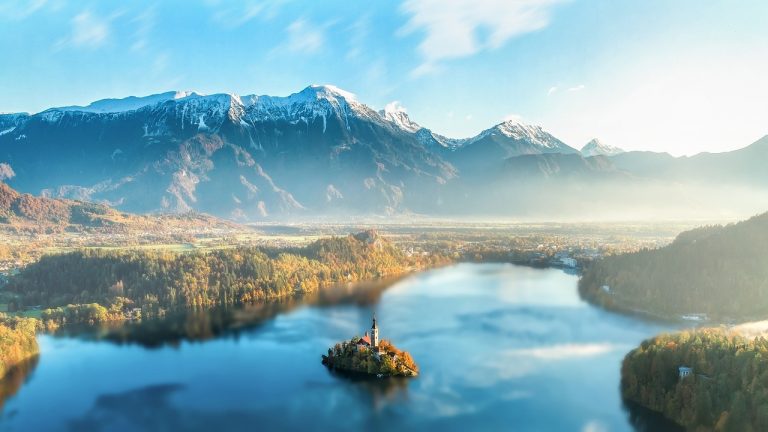
Lake Bled in north-western Slovenia could easily be described as being “Picture Postcard Perfect” with its warm blue waters reflecting the craggy Julian Alps and its tiny island on which stands a church that could have featured in any fairytale. It is by no means a large lake measuring a mere 2,120 m by 1,380…

 Slovenia is situated in Central Europe, sharing borders with Italy, Austria, Croatia and Hungary. One of Europe's youngest countries, it first become an independent state in 1991 after the collapse of the Yugoslav federation. Mostly elevated, the Slovenian landscape consists mainly of charts plateaus and ridges, spectacular Alpine peaks, valleys and basins. The highest Alpine peak in Slovenia is Triglav (2864m / 9396ft.), which literally means ‘three heads’.

